
Information
No Sidebar
This template supports the unlimited sidebar's widgets.For adding widgets to Portfolio sidebar Click Here

Introduction
The research project “Harnessing floods to enhance livelihoods and ecosystem services” is funded by the CGIAR research program on Water, Land and Ecosystems and it is being implemented in the Gash area in Sudan by the Hydraulics Research Center (HRC) of the Ministry of Water Resources and Electricity over the period Jan. 2015 to Dec. 2016 in collaboration with partners, Spate Irrigation Network Foundation (leading partner), MetaMeta, UNESCO-IHE and Mekelle University.
The Research Problem
Recognizing the importance of Flood-based Farming Systems “FBFS” for local livelihoods and economies, the Sudanese government supported by donors such as IFAD started investing in the improvement of infrastructure (weirs, intake and canals) and on-farm practices to enhance agricultural productivity.
However, it is unknown how these interventions at scheme level interact with other functions provided by floods at the local and landscape level and how these interventions affect livelihoods of different stakeholders.
Final workshop
Brochure
More
Photos
[rev_slider amas]Reports
Videos
Partner

Related Projects
-
Water Productivity
This project was one of the outcomes of the strategic partnership-setting meeting between the Minister of Irrigation and Water Resources (MoIWR) and the Food and Agricultural Organization (FAO) Sudan...
-
أثر مياه النيل على العلاقات السودانية المصرية ما بعد سد النهضة
تناولت الدراسة بشيء من التفصيل والتحليل أثر مياه النيل علي علاقات السودان ومصر ما بعد قيام سد النهضة الأثيوبي، وكان ذلك في أربع فصول يحوي كل عدة فصل محاور....
-
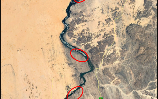
Selection of the Nile gauging site upstream High Aswan Dam
As per a request from the Permanent Joint Technical Commission for Nile Water (PJTC), The Hydraulics Research Center (HRC) conducted a study to investigate a suitable location of a...
-
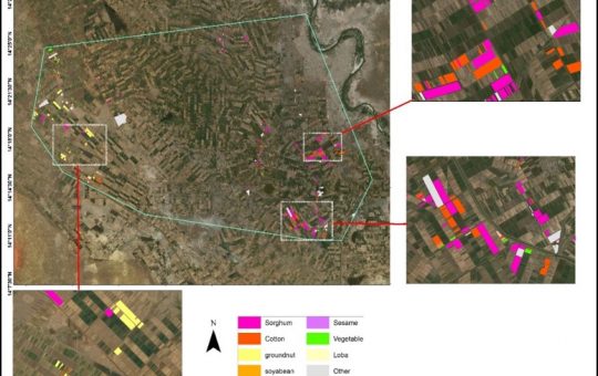
Mapping of Cropped Areas in Gezira Irrigation Scheme Using Remote Sensing and GIS techniques
Irrigation schemes in Sudan face many challenges. One of these challenges is to determine the actual cultivated area for the crops, in particular for large schemes such as Gezira...
-

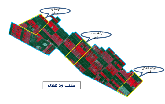
Investigation of the Drainage Problems of Sabir Branch Protective Drain in New Halfa Irrigation Scheme
This study is intended to investigate the flooding problems of Sabir Branch Protective drain, where every year floods flowing from Albutana plateau threatens New Halfa Irrigation Scheme and also...