
Information
No Sidebar
This template supports the unlimited sidebar's widgets.For adding widgets to Portfolio sidebar Click Here

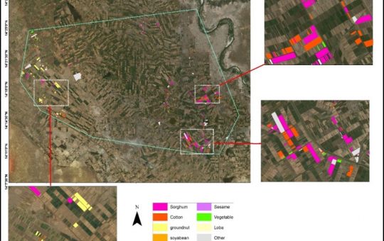
Irrigation schemes in Sudan face many challenges. One of these challenges is to determine the actual cultivated area for the crops, in particular for large schemes such as Gezira (880,000 ha). Mapping of cropped areas using a classical approaches based on ground information becomes complex and expensive. The main objective of this project is to generate crop maps for Gezira scheme using satellite images. This is for winter crops, i.e., images of January/February and summer crops, with images of September/October.
The Landsat 8 and sentinel 2 satellite images were used for mapping the cropped area in Gezira through map classification of three selected agricultural blocks as a sample of the Gezira Scheme. Three canals from each block were selected for ground truthing through precise field survey to assess accuracy of the classification. Then, assuming average classification error from the three blocks to be valid for the whole scheme.
Two methods of supervised classification process were used namely: the maximum likelihood classifier (MLC) and the object-based image analysis (OBIA).
The dominant crops in this season (summer season 2018/2019) were: sorghum, Groundnut, and Cotton, The results (error and area in Feddan) were (±8%, 363,061), (±6.7%, 181,057) and (±7%, 158,977) respectively. The total cultivated area in Gezira scheme was estimated as 706,000 Feddan with an error of ±4%.
This project will continue to map all the crop types that might be cultivated during the winter season of 2018/2019. These outputs are critical not only for proper water management but also for other agricultural processes within the scheme.
Result in October 2018

Result in November 2018

Related Projects
-
Water Productivity
This project was one of the outcomes of the strategic partnership-setting meeting between the Minister of Irrigation and Water Resources (MoIWR) and the Food and Agricultural Organization (FAO) Sudan...
-
أثر مياه النيل على العلاقات السودانية المصرية ما بعد سد النهضة
تناولت الدراسة بشيء من التفصيل والتحليل أثر مياه النيل علي علاقات السودان ومصر ما بعد قيام سد النهضة الأثيوبي، وكان ذلك في أربع فصول يحوي كل عدة فصل محاور....
-
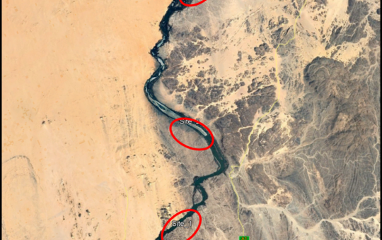
Selection of the Nile gauging site upstream High Aswan Dam
As per a request from the Permanent Joint Technical Commission for Nile Water (PJTC), The Hydraulics Research Center (HRC) conducted a study to investigate a suitable location of a...
-

Investigation of the Drainage Problems of Sabir Branch Protective Drain in New Halfa Irrigation Scheme
This study is intended to investigate the flooding problems of Sabir Branch Protective drain, where every year floods flowing from Albutana plateau threatens New Halfa Irrigation Scheme and also...
-
Satellite Based Information and Communication Technology (ICT) for Improved Crop Production in the Gezira Scheme
Water scarcity and food security are key concerns for the growing population in the arid and semi‐arid zones. Water is becoming an increasingly scarce resource for agriculture and other...